It was like this challenge from Beth of Wandering Dogs was just meant for me! I just returned from a scenery change. After a year of wandering around the Sacramento area with my photography pod, my friend Sandy, who lives in Tuolumne City, invited me to spend time with her and her sister Peg in Windsor in Sonoma County, California. I didn’t need to even think about it before I said YES!
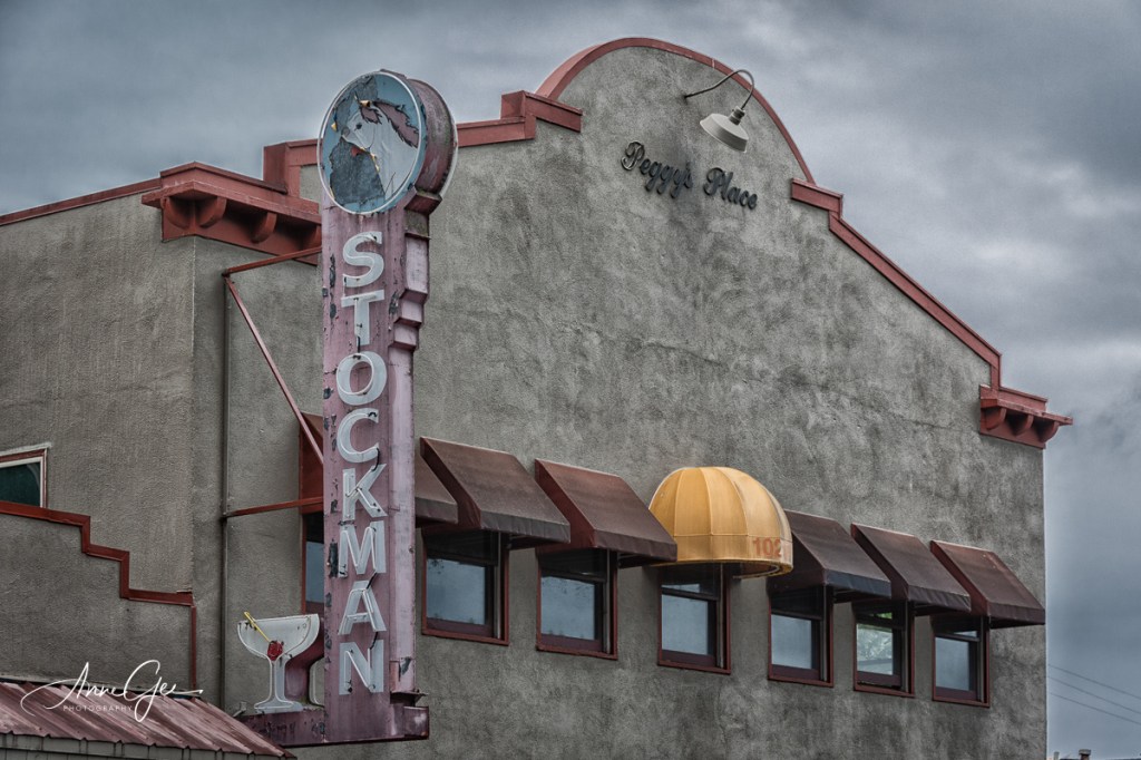
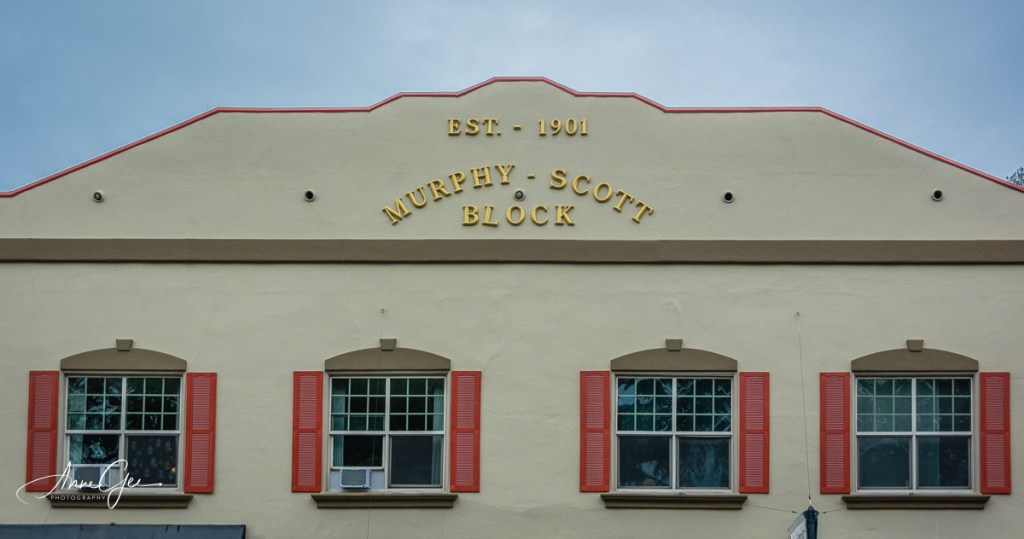
Sandy picked me up on Monday and returned me on Thursday. We had two full days of seeing the sights and taking pictures. I haven’t been able to edit all the pictures yet, but I can show you the small town of Windsor.
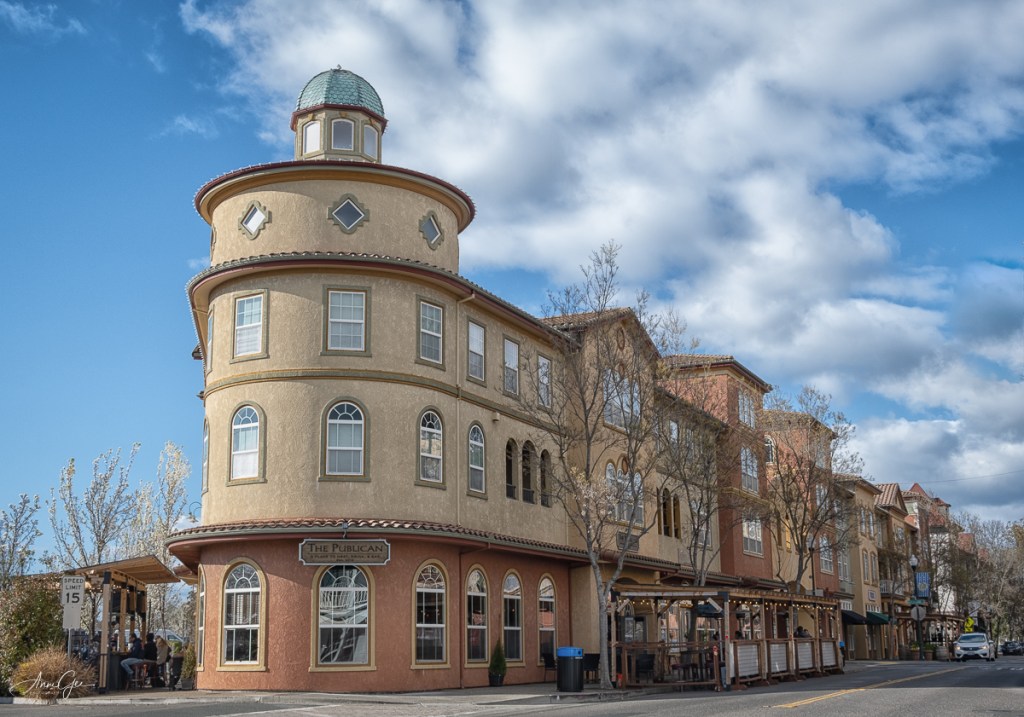
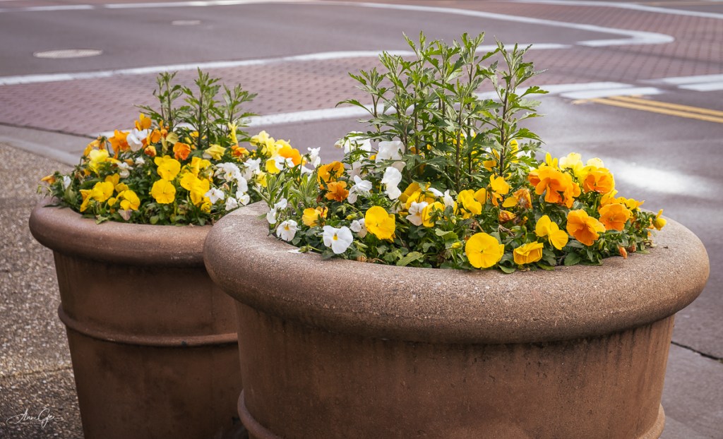
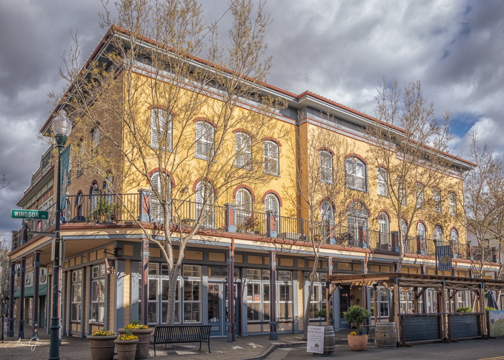
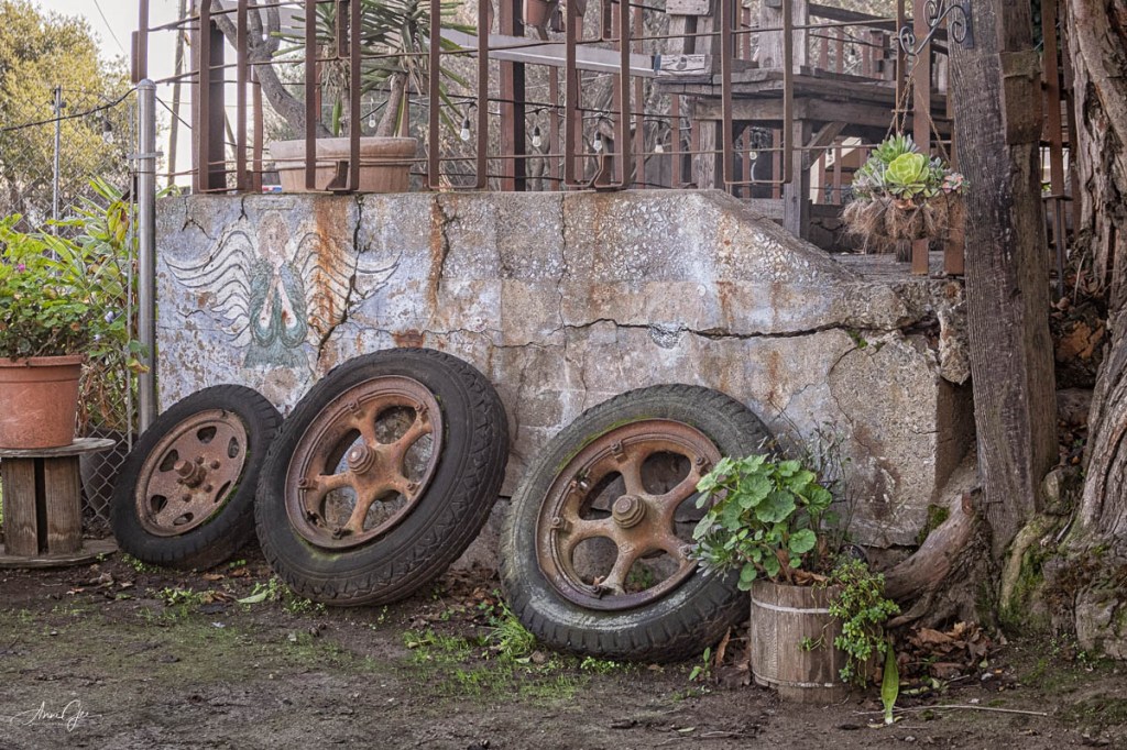
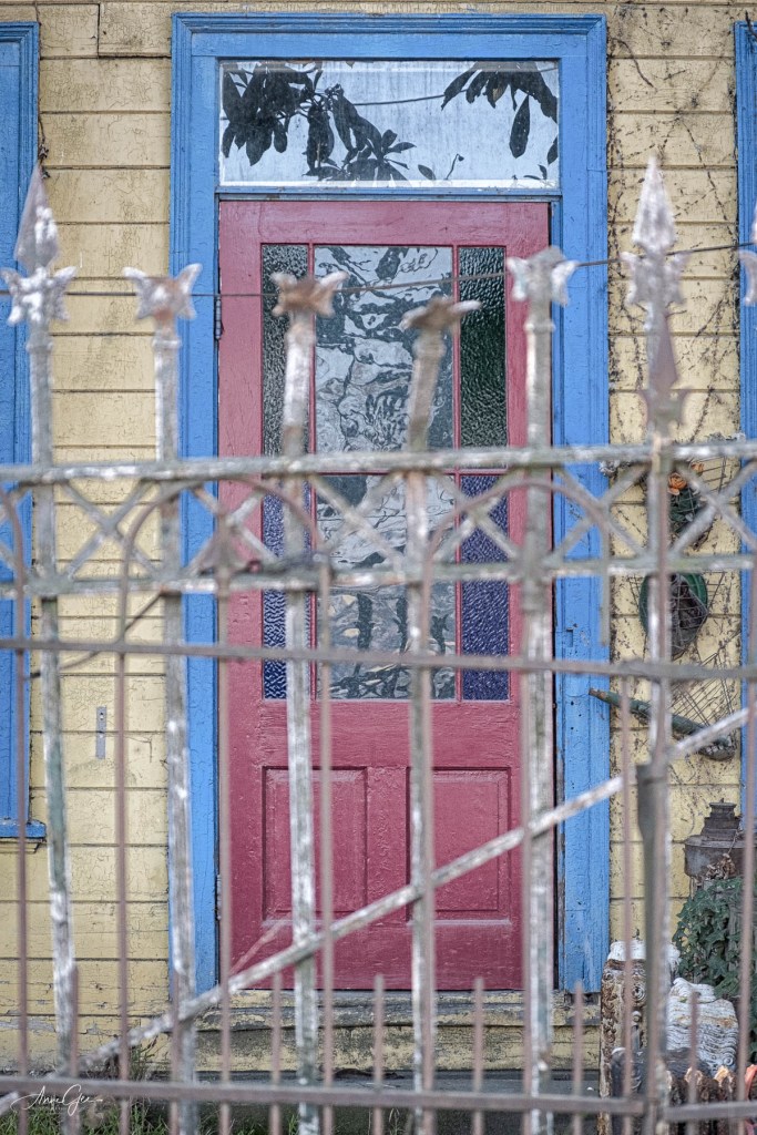
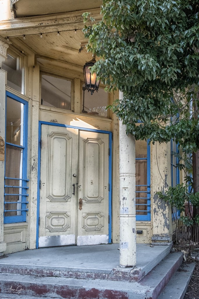
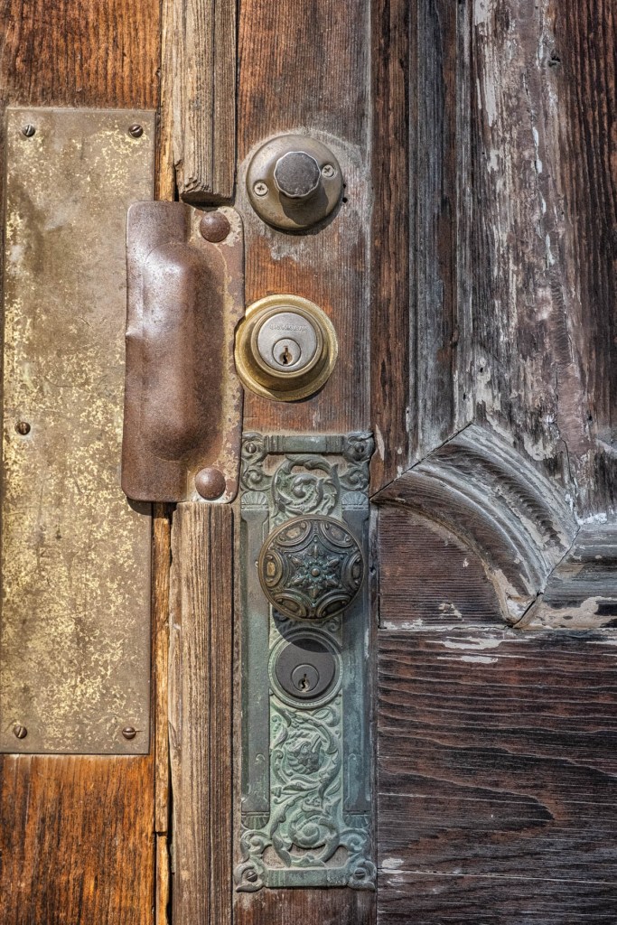
Here are the small shops and buildings in the downtown area.
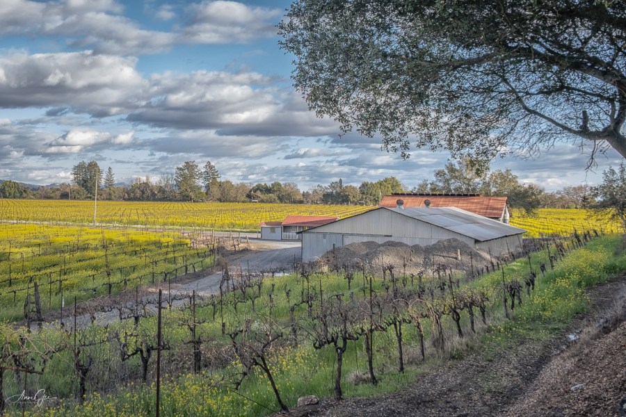
From the town we go into the countryside.
Day two had us go to the coast, ending up at Fort Ross State Historic Park. The next day we drove through Napa. Those pictures still need editing.
I totally needed and enjoyed my time away. A change of scenery is always a good idea, especially after a year of in and out of lockdown. And thank you Sandy for driving and Peg for your hospitality.
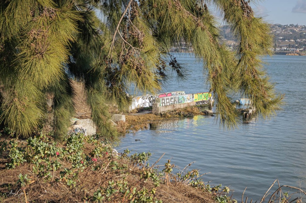
Bulletin: most places won’t let customers use their restrooms because of COVID! That’s what Jean and I found out when we left recently to drive out of the Sacramento Valley with our cameras. We were driving to Port Costa, an old little port city in Contra Costa County. I had been there twice before, but that was several years ago. Nothing changed! I decided to take pictures in a way I didn’t before.
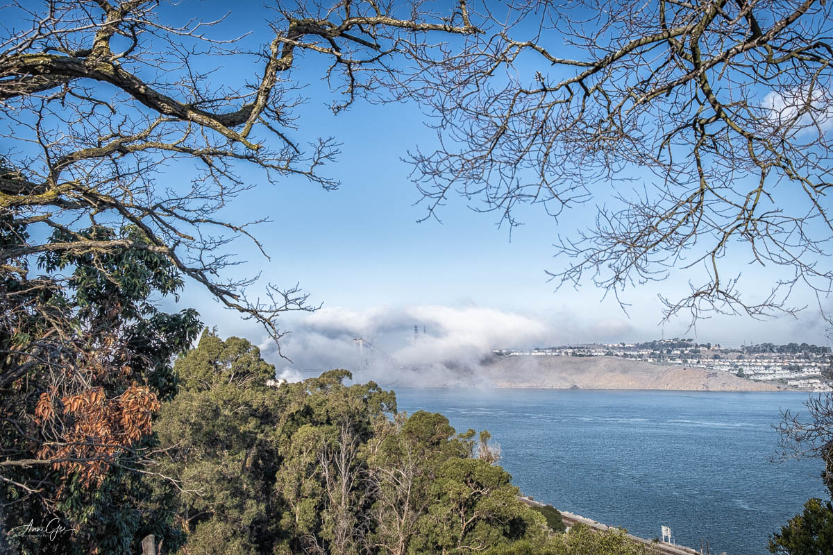
On our way down to the port, we stopped at this viewpoint to take a picture of the Carquinez Bridge while it was being enveloped by approaching fog. A couple of seconds after I took this image, the bridge was totally fogged in.
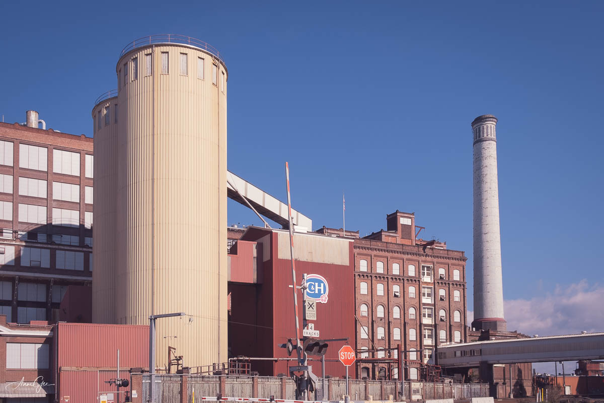
We then made the usual stop at the C&H Sugar refinery. Photographers are not allowed in, but they do let you take pictures at the entrance. You may have seen this view before if you’ve been following this blog for some time.
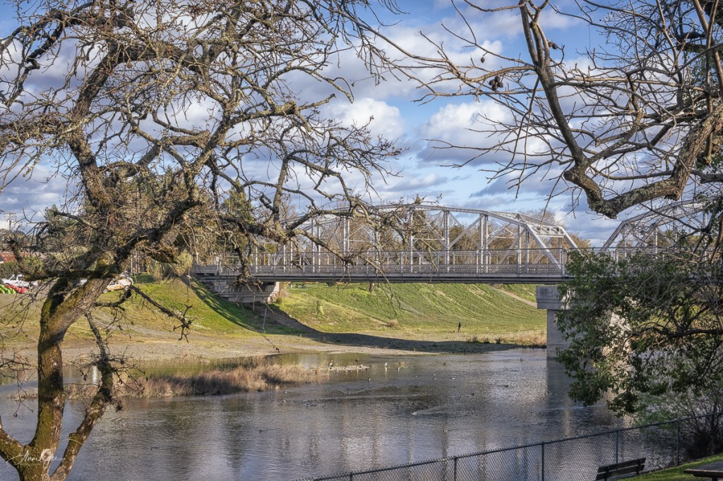
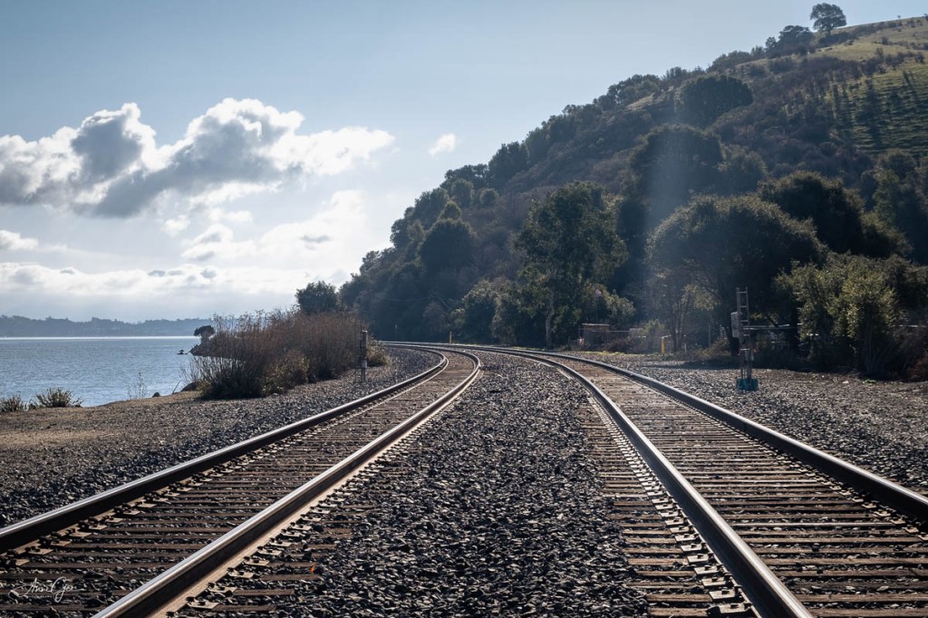
Now for Port Costa itself. The railroad still runs by it.
The town is old and the hotel shows it. Homes are overrun with overgrowth.
The shoreline, beyond the railroad tracks is interesting and we saw some kayakers paddle by.
It was just before we left Port Costa that we realized there was not a public restroom to be found. We did find a portable toilet at a small park near a fishing pier. The flush bathroom was closed. It was a good stop in more ways than one!
The Carquines Bridge
The sugar factory in the distance.
The guys said no fish today!
Before heading home, we stopped at Mare Island. I knew that the only public restroom was in the museum which was closed. There was a Navy ship in for repairs. No, we couldn’t go on board! So, after taking our pictures as best we could because it was all fenced off, we headed to a Starbucks in Vallejo.
When we found the Starbucks, we were allowed to buy coffee but not use their restroom! CostCo to the rescue. Fortunately there was one on the way home. All in all, it was a fun day. We did learn, though, not to go too far from home!
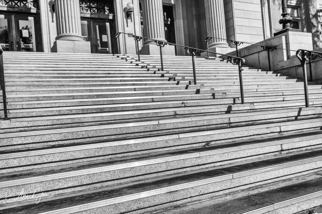
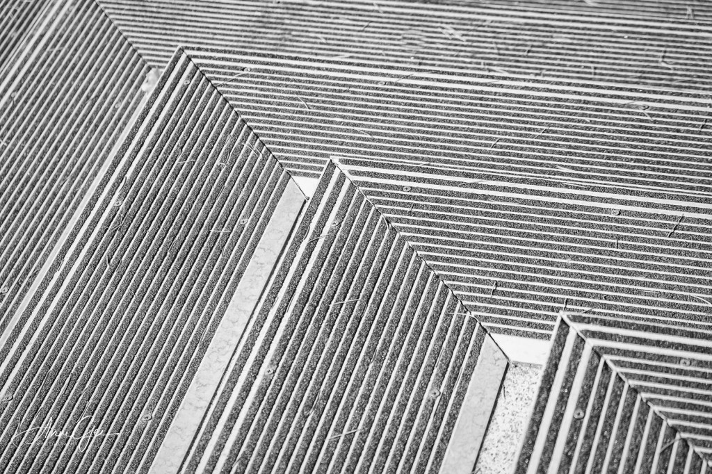
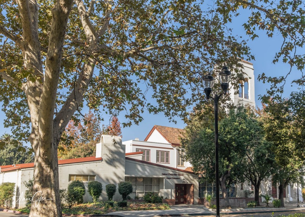
These days, we’re not doing many full day trips, but opting for a few hours near by. So, last Sunday, we (Ray, Karen and I) went to Woodland, a small town about 30 minutes north of Sacramento. It’s been a while since I’ve photographed in Woodland, and it was a nice walk.
We took photos of the old courthouse. I was practicing lines and patterns. The courthouse is a beautiful old building which was replaced by a more modern structure. It was also nice to see a memorial to Yolo County Police Officers.
We walked along streets and found some nice structures and flowers. I’ve also discovered that Photoshop has now an easy sky replacement and I had fun working with it in post processing. Now I have to get some skies of my own!
We ended up at the library where we found more flowers and a beautiful building. It was breezy, maybe too much for a macro lens. I shot these with an 18 – 55mm lens.
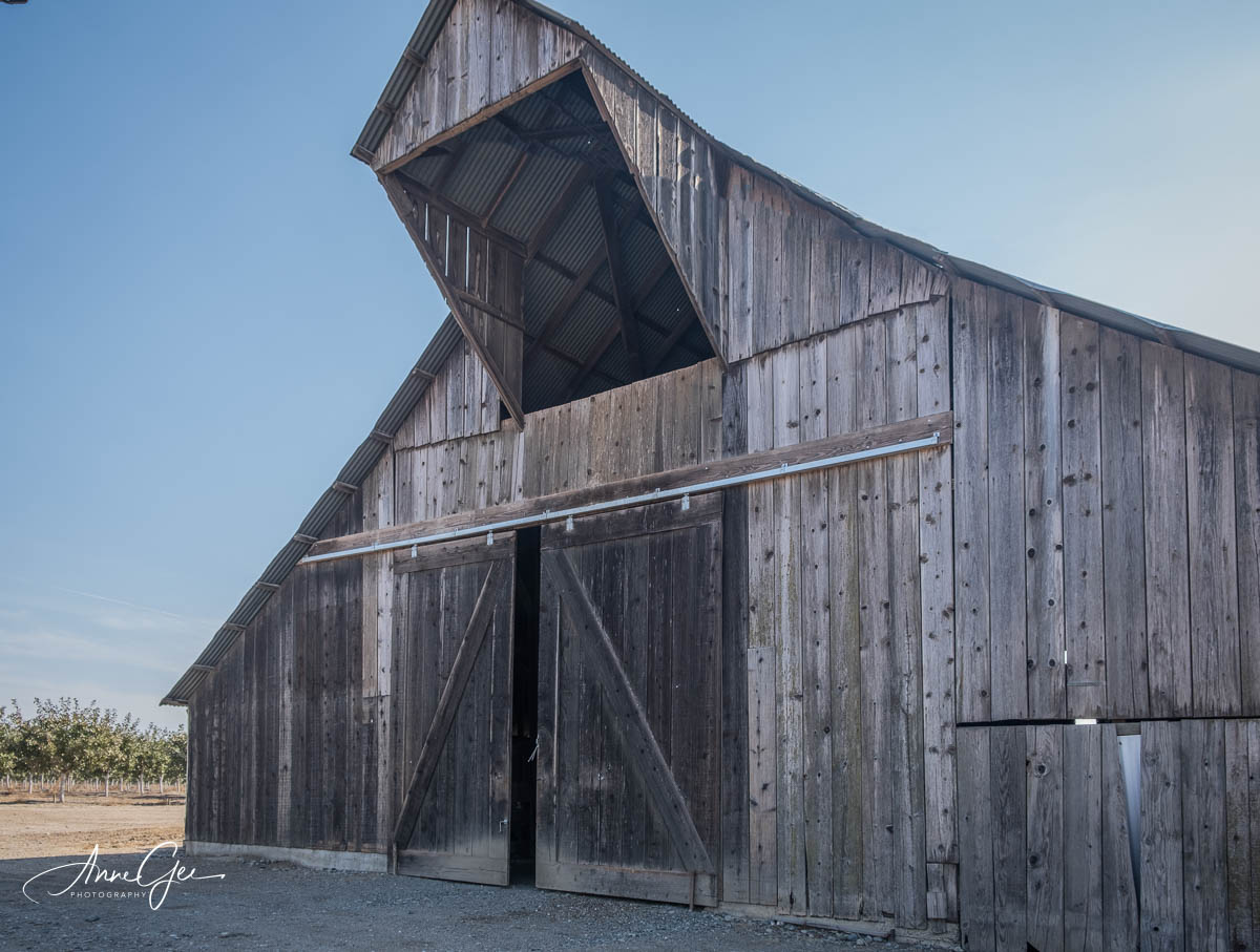
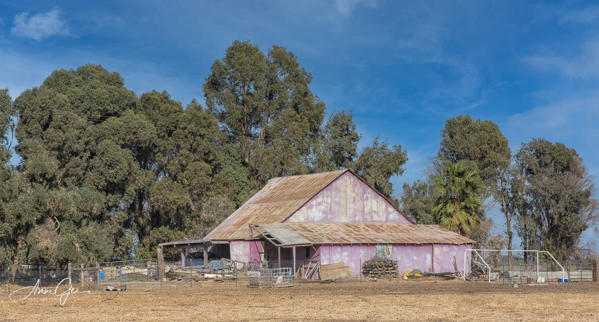
Before heading back, we went out of town and into the countryside to find barns. We did find a couple, and one was pink!
It was a wonderful short get-a-way. We’ll have to find more since COVID is still raging.
Let’s go back to early September when the West Coast was under fire. Smokewas everywhere. I was getting a bit of cabin fever. Before the fires ignited, I would go out with my photo buddies maybe once a week and we’d drive separately, mask up and enjoy a couple hours of photography. That was enough to keep me smiling while at home.
But since the fires, and the resulting smoke, it wasn’t healthy to be outdoors or let alone shoot. I was trapped. I was walking around our small house complaining and complaining. It must have been bad because Richard said, “Let’s get in the car and go for a ride.”
So I grabbed my camera, never leave home without it, and off we went. Our goal was to stop off and find some of the small towns advertised at freeway off Ramps. Our first stop was Alta, a very small town. This is what we found in Alta.
Now there must be more support businesses and housing, but we didn’t find it close to the freeway. Next stop Dutch Flat.
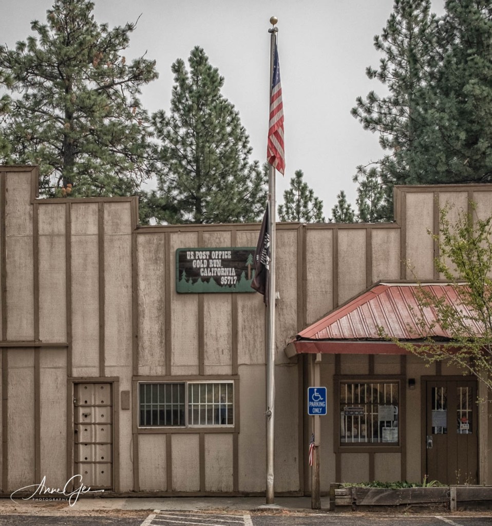
Remember, we just drove along the main streets in these small towns. Next came Gold Run.
We were on our way home when we stopped to see what this was.
I’m thinking it might have been a flume used to float logs down the mountain. Any other guesses?
So that was our short trip up the I-80. We never did get anywhere near Reno! Maybe next time.
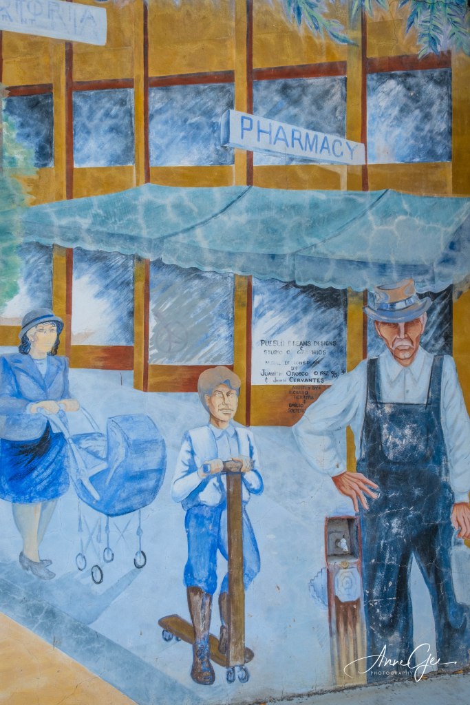
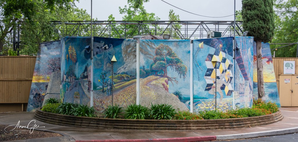
Maybe it’s all in my mind, but I think I hear my camera calling to me. It’s saying, “Take me out! Use me!” But because of all the wildfires in California, the air has been too smoky to go out. But I did get out with my camera at the end of August to shoot murals in downtown Roseville.
Downtown Roseville is mainly Vernon Street and the streets surrounding their City Hall and other government buildings. Historic Roseville is nearby. But we went downtown to take pictures of murals. Quite frankly, I didn’t think they compared to the Wide Open Walls creations in Sacramento.
We walked quite a bit that morning just enjoying being out, the sunshine and no smoke. Here are some murals.
I took this wide and then broke it up into two images. You’ll have to click on the images to view them full.
Another wide and close up view.
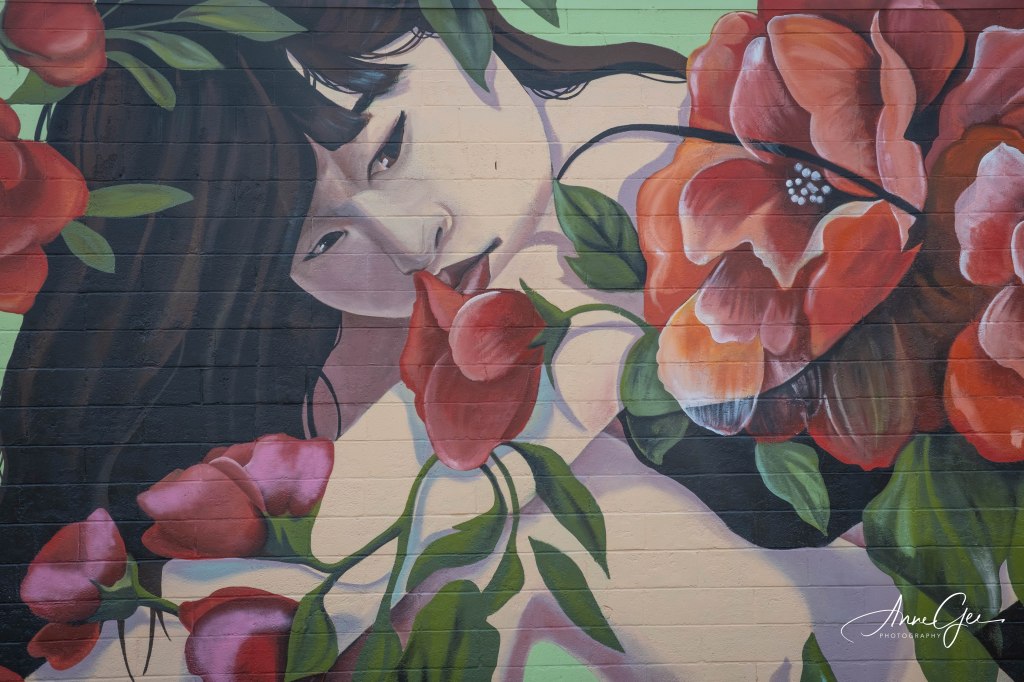
I thought this one was very creative. Here’s a wide view and close up of her face.
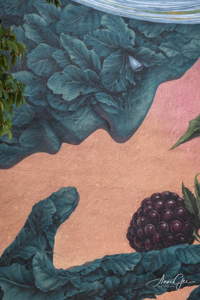
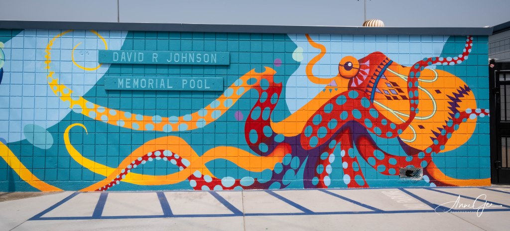
This one was on the wall of a public swimming pool. I loved the colors.
And just one more.
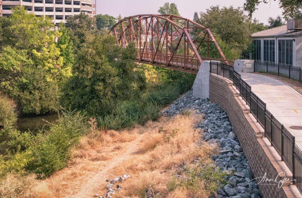
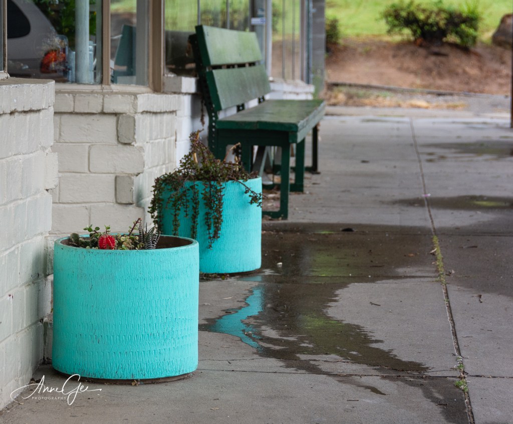
I hope you didn’t think we’d just take photos of murals! Here’s some of the downtown shops.
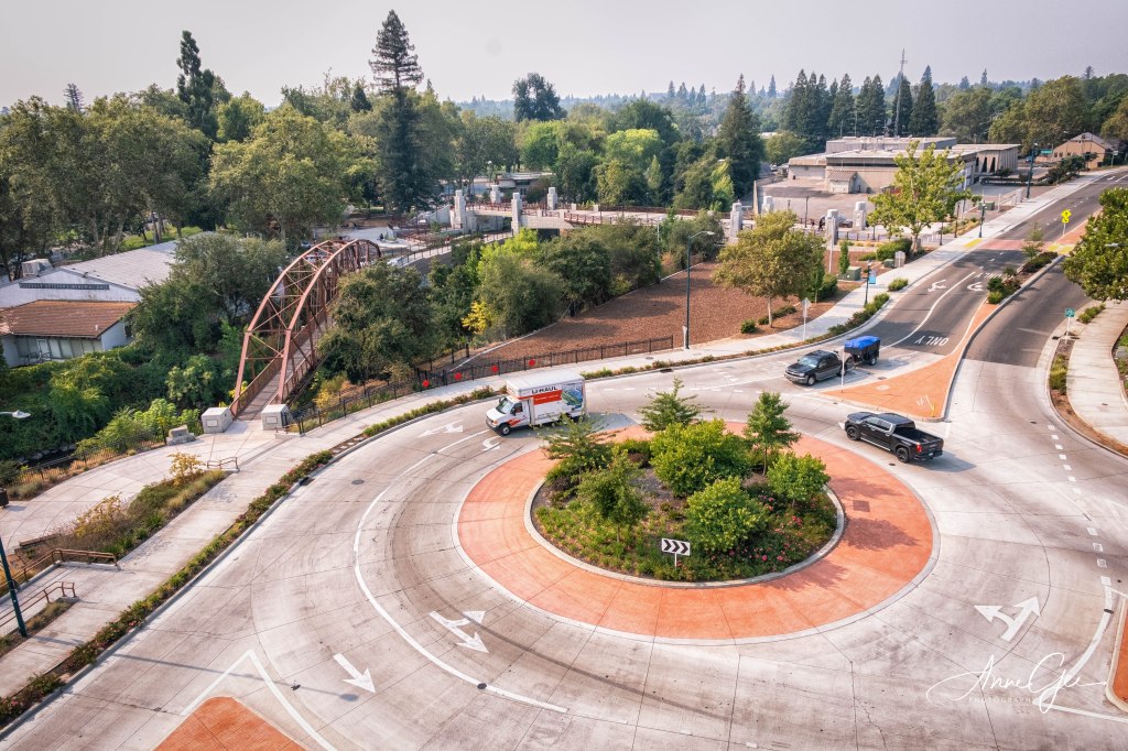
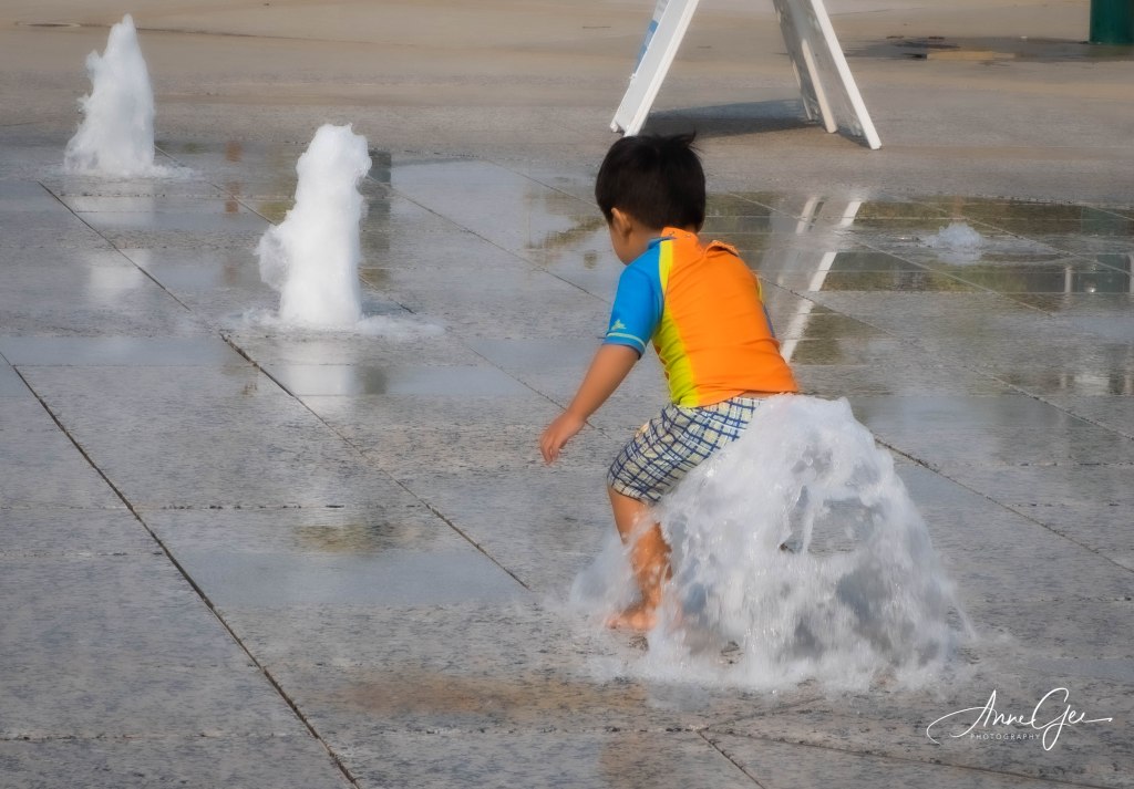
And now around City Hall. The Round About, a water play area with fountain and the Roseville welcome structure, showing which street goes which way.
I hope you enjoyed your little tour of Downtown Roseville and murals. This Sunday, if the smoke is still gone, we will be taking photos of the Sacramento murals.
Cross your fingers for me. The camera will be unhappy if it can’t get out!
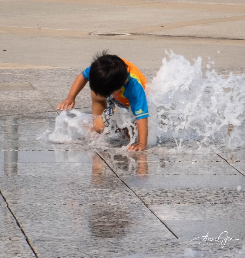
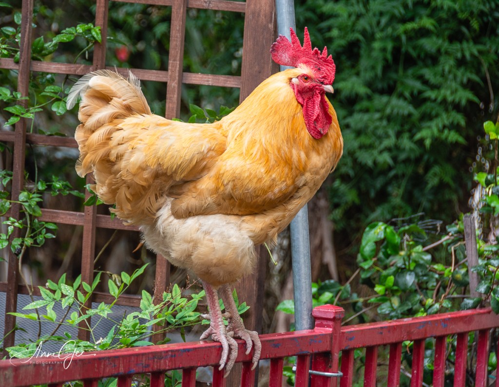
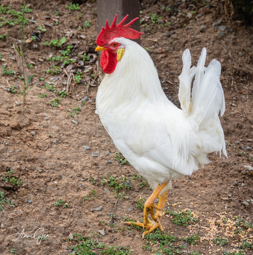
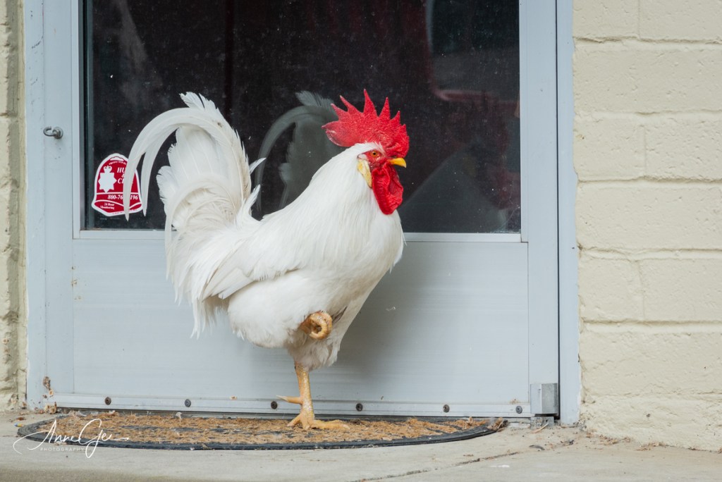
It was a dark stormy night–not really, but it was a cloudy, almost raining day when a small group of us decided we needed to get out and take some photos. So, we followed the chickens to the small old town of Fair Oaks in Sacramento County. Yes, chickens are plentiful there. The roosters are bold and noisy, but have great color. They are the attraction, and don’t have to wear masks or stay 6 feet apart!
The small area was desolate. There were a few people roaming around. The stores were closed except for a cafe where people were eating and enjoying coffee outside. It felt strange, experiencing Fair Oaks during lock down.
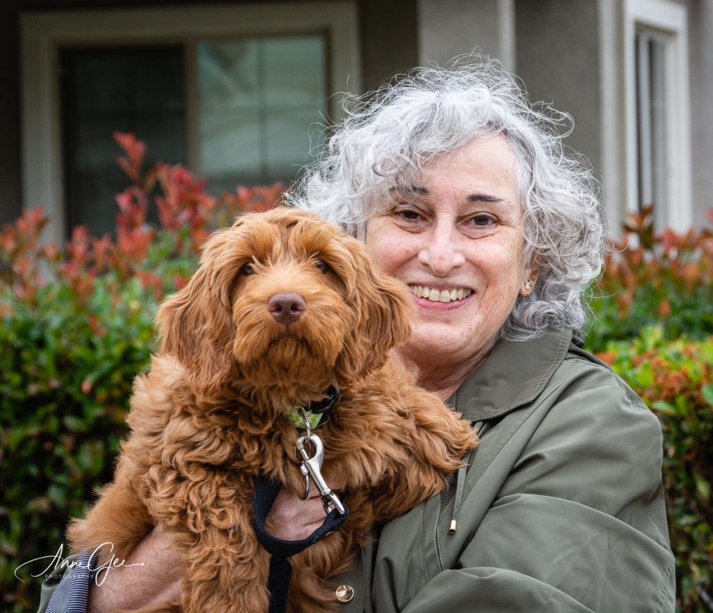
We did stop for coffee at the cafe and sat outside before heading our separate ways. (We don’t carpool anymore. We drive separately.) On the way home, I stopped at Marlene‘s to meet her new puppy Charlie, an Australian Labradoodle. We met outside and observed the correct social distancing. The reality was that Charlie didn’t want to come to me! He finally got to the point of coming close, but that was about it.
During our stay, the sun peaked out at times but quickly hid behind the clouds. It was a fun time though with the chickens and photo buddies!
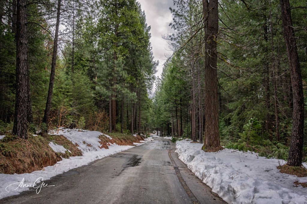
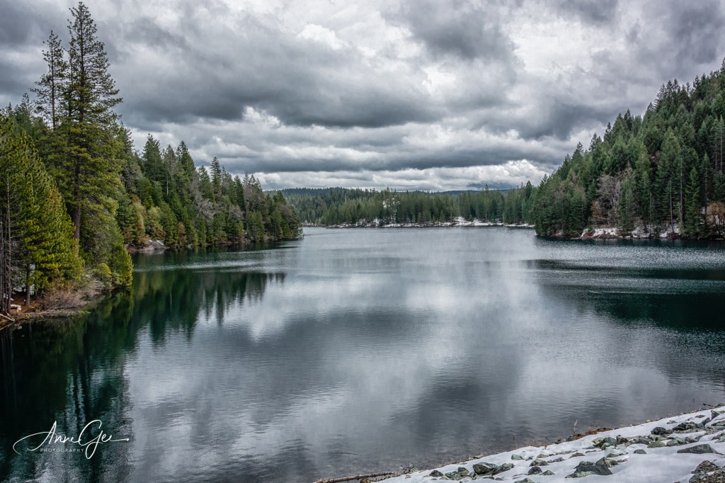
Richard was getting cabin fever so we decided to take a ride up to Sugar Pine Lake in Placer County. Sounds easy and simple! Sure, until you miss your exit off the Interstate and one of you is working on erroneous information. Right now, I’ll admit that one was me! I just didn’t know there was a difference between Sugar Pine Lake and Reservoir. So, I suggested we follow the GPS to the Dam and Reservoir. (Now, as I’m writing this post, I’m learning there isn’t a difference! Now I’m more confused.)
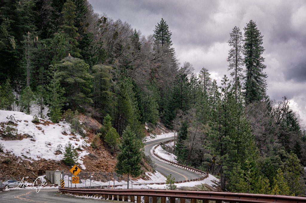
Oh no! Well, trouble didn’t begin that soon. We found ourselves on Iowa Hill Road. Never heard of it! In fact, we never heard of Iowa Hill, but we found it. On our way up the paved, curvy mountain road, we found a neat specimen from long ago. Why it was on the roadside, we don’t know. Maybe just to be an indicator of things to come!
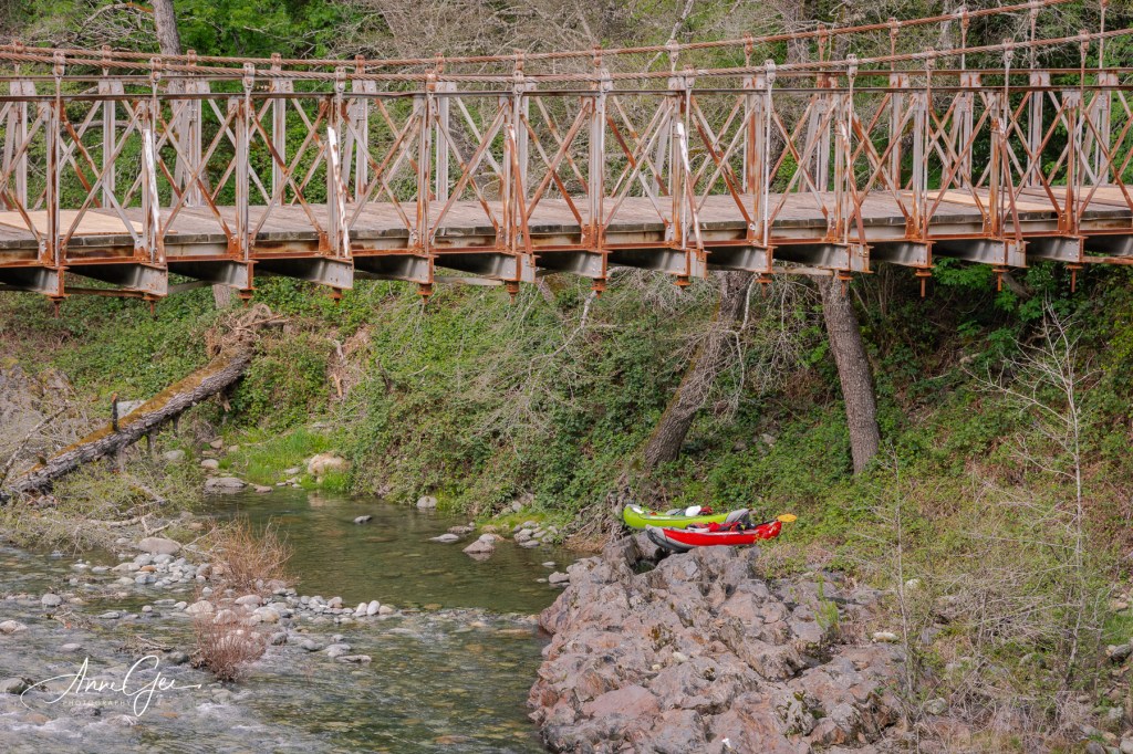
Further up the road, we crossed a river (not sure which one), but were encouraged by the canoes we saw on the bank. We also saw the old Iowa Bridge.
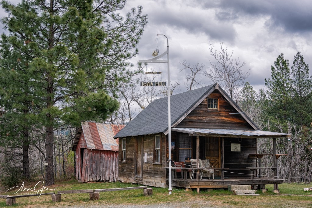
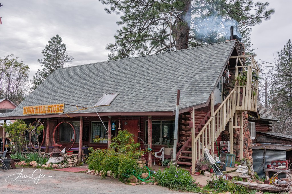
Driving on a narrow twisted road we soon reached the small town of Iowa Hill still not aware of what was ahead.
Once out of the small town, we driving where snow was still on the ground and over another river. We did find the lake and dam.
Now to get home! Again we followed the GPS which took us almost the same way we came.The dirt road began to narrow to one lane and what was probably snow left the road a little muddy!
Now, each time we made a turn, the GPS said stay on the route for 5 or 6 miles. I stopped counting the turns as the road had more and more debris on the sides. I would have gotten out to take a picture, but the road was just wide enough for our car! Richard said, “What will we do if someone was coming from the other direction?”
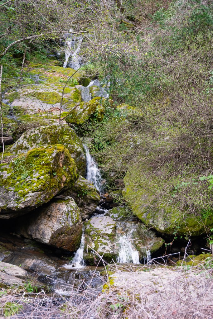
We both said at the same time, “No one else would be stupid enough to go this way!” Got to have a sense of humor in a situation like this. I estimate that we drove about 15 miles on that road. Close to civilization, we came upon two small waterfalls. There was enough room at each for me to step out of the car and shoot pictures!
As we were churning up mud, I thought if anything happened, nobody would know where we were. We didn’t have cell service and didn’t tell anybody we were going for a ride. Lesson learned. Now, we will definitely tell family where we’re going!
As long as we’re under lock-down, we will be taking rides. After all, it’s the safe thing to do if you don’t miss your turn off!
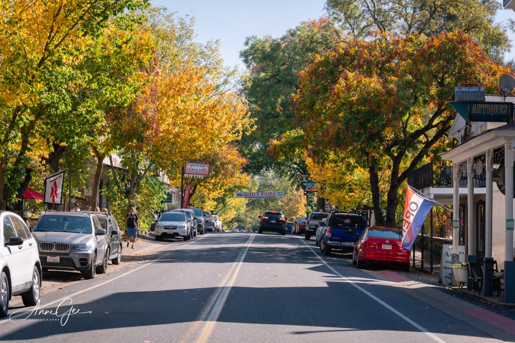
Coffee was calling! So on the way to Big Trees State Park, we stopped in the small resort town of Murphys. This town was our lunch stop when we were shooting the Concours d’Elegance at Ironstone Vineyards. You can see that post here. Well, we got more than just coffee!
This home owner was so happy that we were taking pictures of her quaint house.
I liked the tiling on the steps.
This collectibles shop caught my eye.
A group was touring the town.
No, we didn’t have coffee here. Too crowded!
Okay, he’s just cute.
Jean said she and her husband stayed at this hotel many years ago.
Autumn colors on Main Street.
Ready and waiting for anyone who wanted a ride.
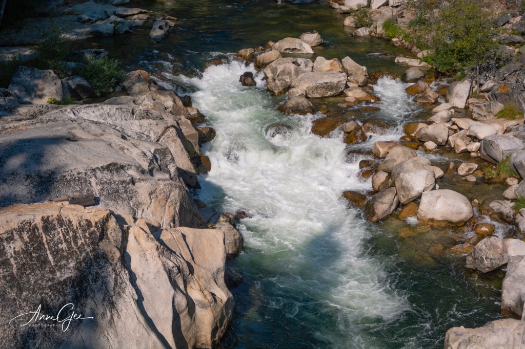
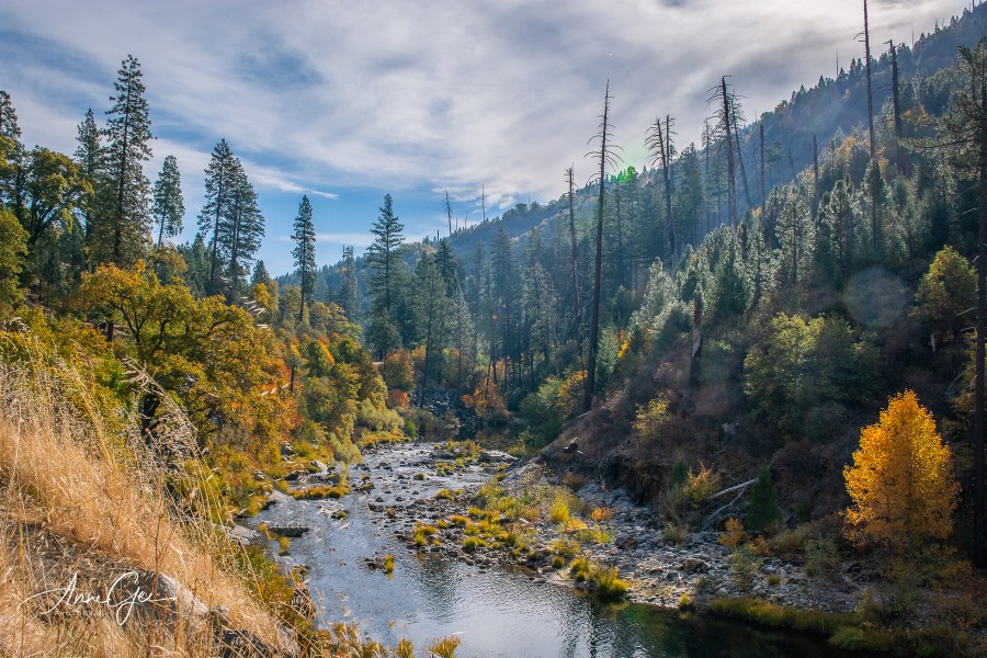
After our visit to the State Park, we stopped near a bridge to capture the scenery.
Trying to get some silky water hand held.
Beautiful stream.
Shadows and light.
Last, we made a stop at Ironstone Vineyards just as they were closing. Jean had never been there. Fortunately, we had just enough time to see the grounds and shoot some flowers.
If I thought 2019 would start off with a BANG, I was wrong. I didn’t hold a camera in my hand for the first two weeks. After that there were five photo opportunities, but few great photos. A lot had to do with the rainy weather, which we’re still having, and also with my not feeling well.
So here we are in February and the rain is still coming down. I’m not complaining because California needs the rain. We have a great snow pack now that will hopefully see us through the dry summer. What does that mean for photography? If you can’t make it up to the snow, you’re shooting inside! I’m amazed at how many businesses welcome photographers. This year we’ve been to the Antique Trove in Roseville twice, most recently today. You’ll see those pictures in my next post.
So, here are some picks from January!
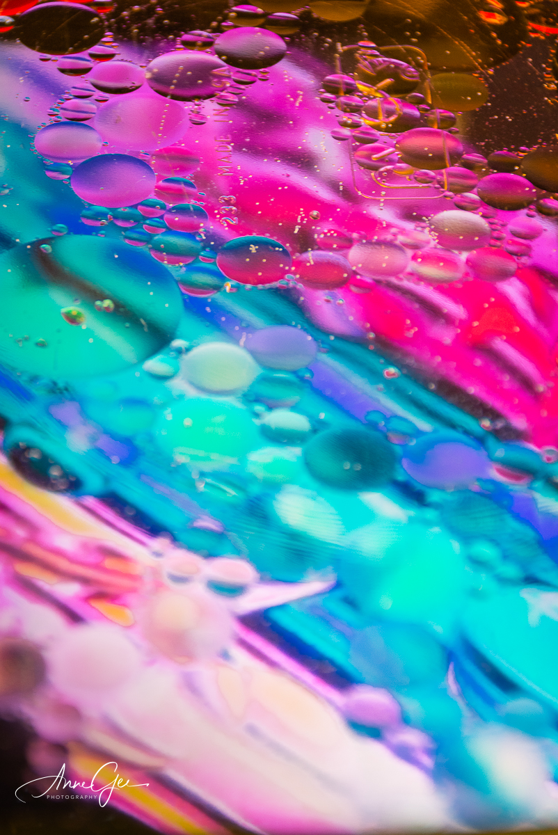
These were from an experiment with oil and water. It’s more difficult than the tutorial made it seem!
These are from an outing to Old Folsom Historic District. It’s a section of Folsom where you can walk, shop and eat. Best of all, the parking is free!
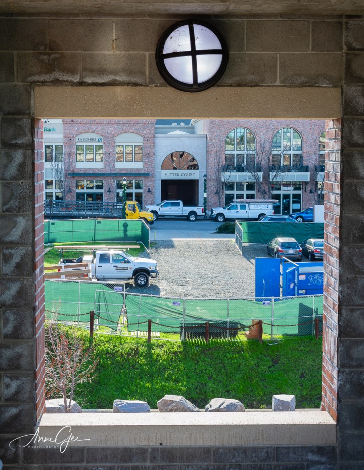
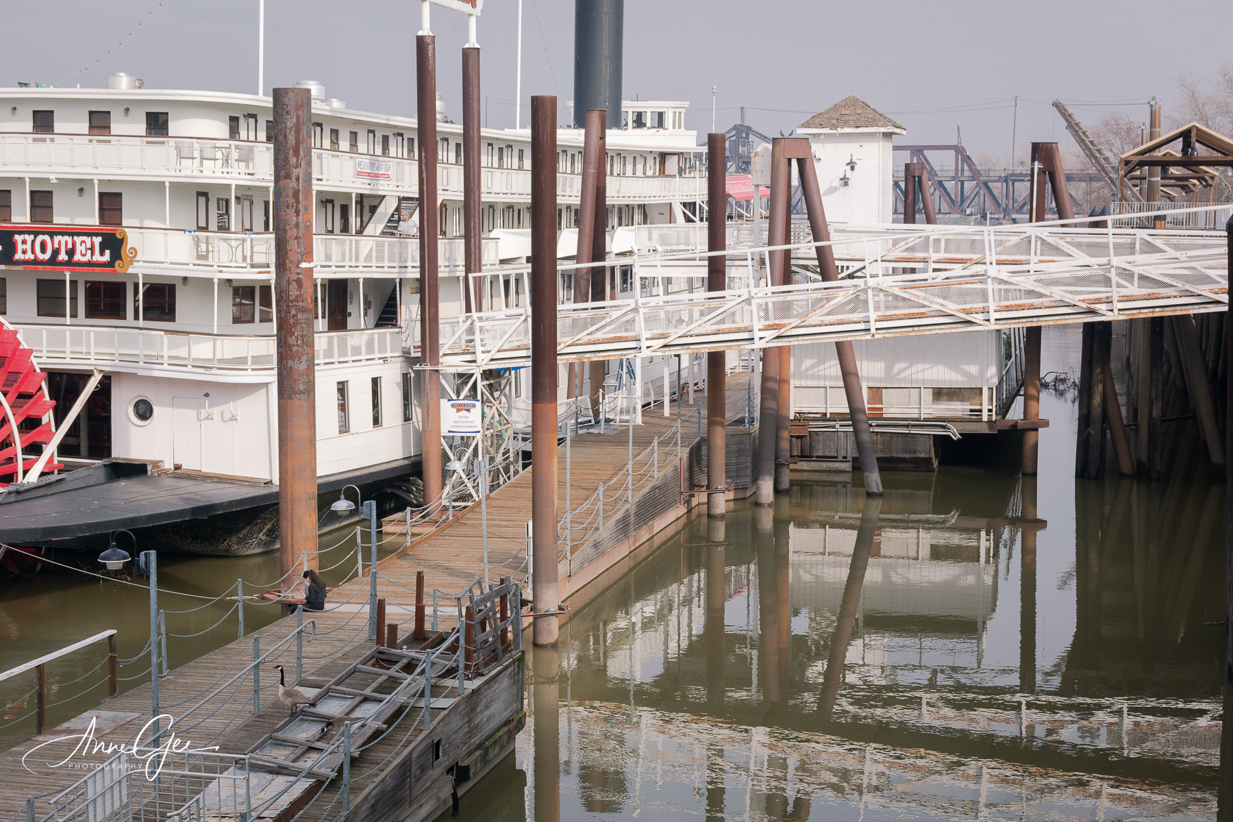
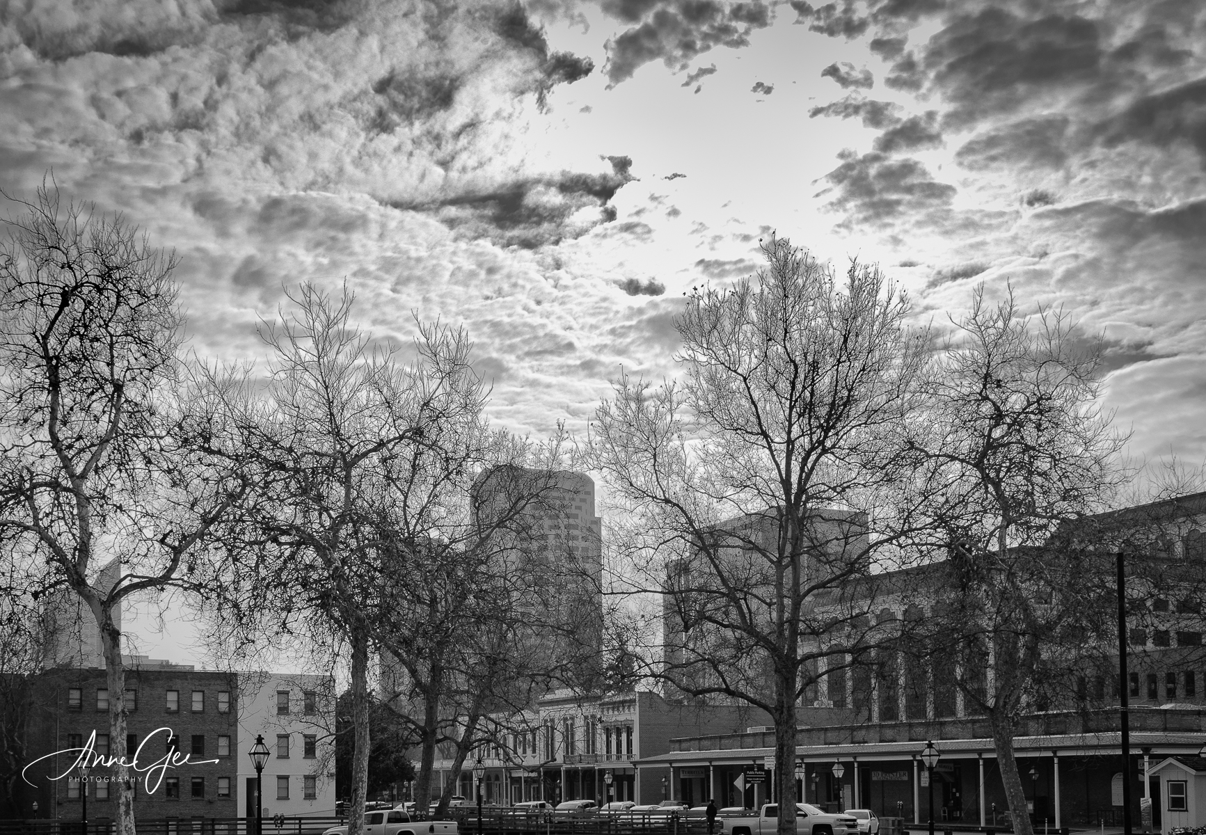
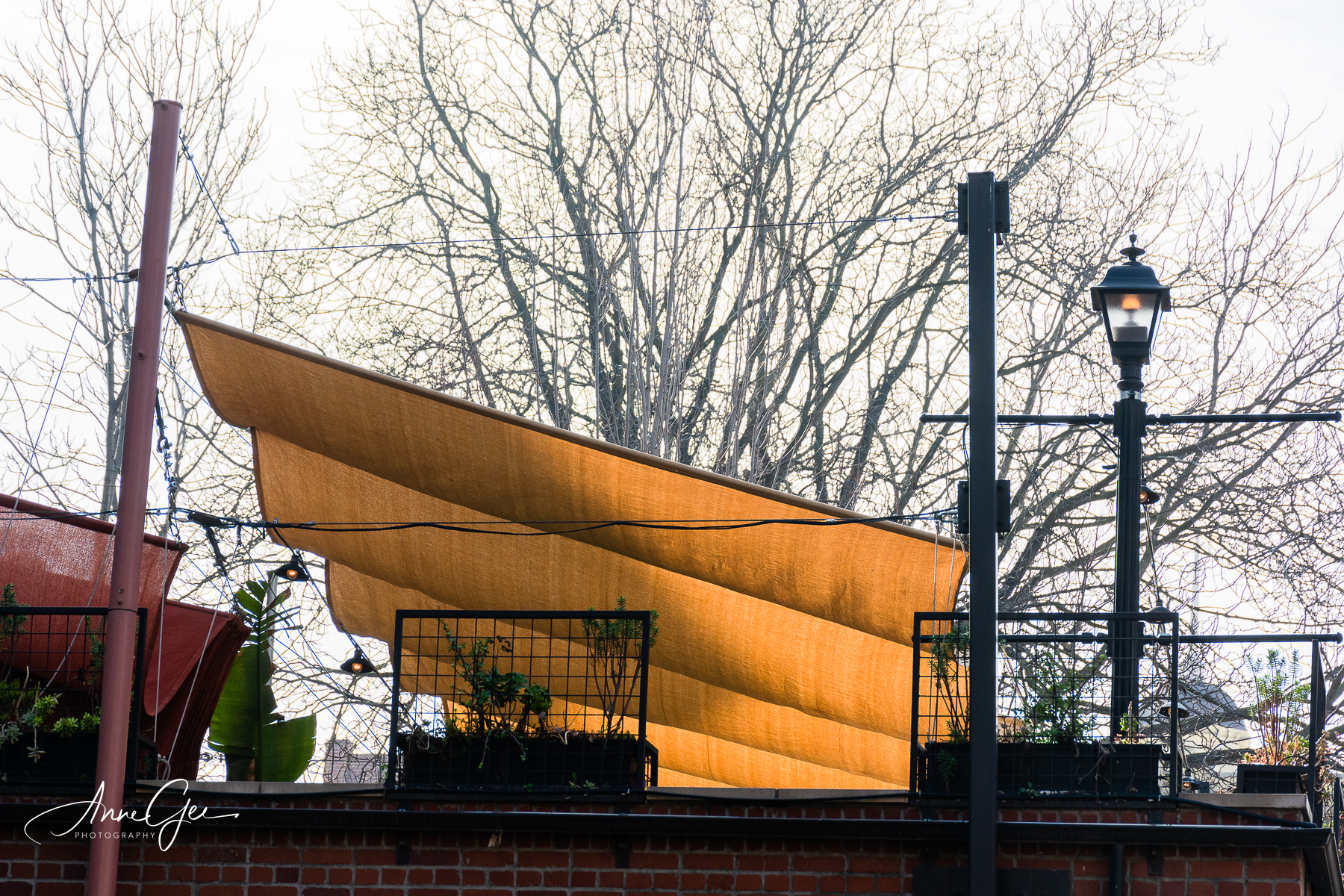
This next outing was to Old Sacramento. I’ve shown you images from there before. It’s always a challenge to find something new.
It seems that with each season Sacramento photographers rush to photograph the Milky Way, wildlife including the Sandhill Crane, snow and Fall colors. I’m no exception which is why my Camera Totin Tuesday group treked up to Markleeville, Alpine County, to capture delightful images.
There were five of us, and we squeezed into one car. Fortunately Marlene drove and her Suby Blue accomodated us easily. It’s a 2-hour ride up to the colorful aspens. Thank you Marlene for driving us. We stopped along the way to photograph the changing colors and had lunch in Markleeville. After lunch and taking pictures of the small town, population of 210 in the last census, we continued looking for color.
While editing the pictures of this outing, I tried to get out of my comfort zone with some creative help from Nik software. I’ve been liking the soft look lately and wanted to do some of my own. So, here’s the California colors of Fall.
A softened Aspen image.
Color in all its brilliance.
Another softened image.
We stopped on the way up.
You’ve got to love sunbursts.
Along the highway.
Around the area.
This guy holds down the bench!
A Markleeville building framed by color.
Two fences and a structure.
Photo buddy Richard showed me this shot.
I’m not sure what flower this was, but it’s still beautiful.
Old barns.
A book worm topiary in the back of the town’s library.
We stopped on the way home.
The tree glow is reflected in the water. Also tried handheld slow shutter.