The photo journey continues: Day 2 in the Sonora area

It’s living a dream. I wake up in the morning and my friend asks, “Where would you like to shoot today?” Of course, I didn’t have a clue, but it felt great to have someone willing to guide you through a day of photography. Our second day of fun was about to start.

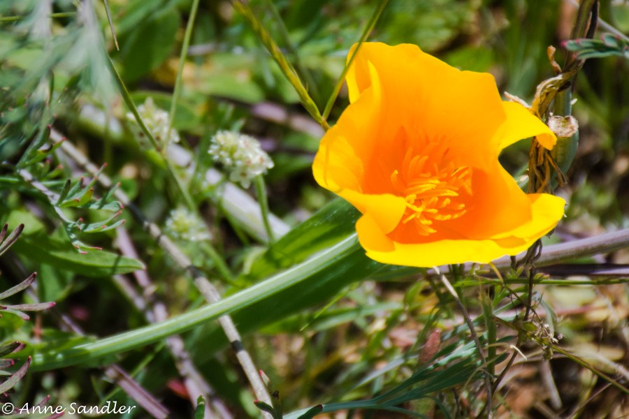
Sandy and Ken first took us to the Red Hills ACEC, an Area of Critical Environmental Concern. This land was designated ACEC in 1993 to protect flora, a rare minnow  (Red Hills roach) and the bald eagle wintering habitat. We didn’t see any eagles and wouldn’t know a Red Hills roach if we saw it.  Sandy and Ken had never been there, but Sandy heard that wildflowers were blooming in that area. So this was an adventure for all of us.

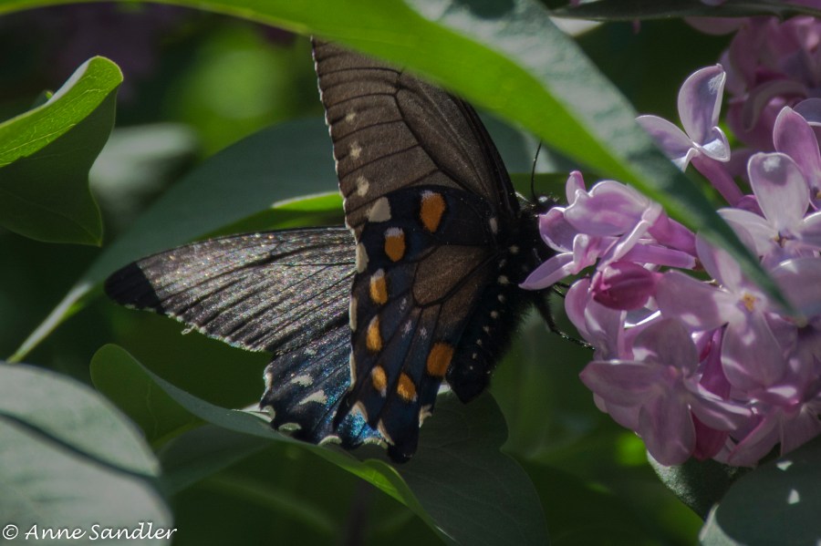
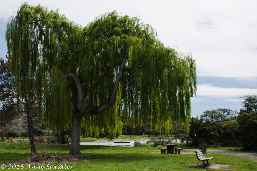
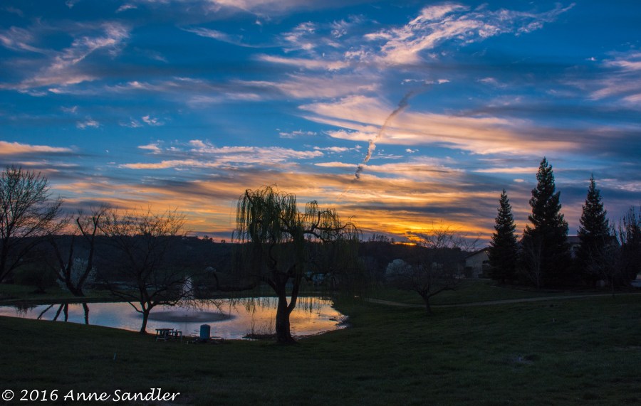
It’s a good thing Ken’s Subaru has all-wheel drive because our adventure took us through some very rough and ready dirt roads. We had to cross three streams. I think Ken enjoyed the drive. There’s a daredevil in that body! While we were being jostled around, we did get some beautiful images of beautiful scenery.

After lunch, we went to Railtown 1897 State Historic Park. Ken serves as a docent there so we wanted to see what captures his heart. Another docent, Paul, took us around. This is a working facility. They rebuild old trains, give train rides on the weekend and house several stars! Do you remember a television series called Petticoat Junction which ran from 1963 to 1970? Train number 3 was on that show. It was also featured in many movies and is still in demand.

Paul took us through many areas of the roundhouse and showed us the grounds. It was a great tour. When I wake up tomorrow, where will my dream take us?

Been shooting too much? The Gold Country

I never thought I’d say that I’ve been shooting too much! But here I am, way behind in editing and still shooting. I’ve even fallen behind in posting my 52-week images. So I’ve vowed to not shoot any more photographs until our Camera Totin’ Tuesdays group goes out on Tuesday.

I have been exploring the new Nik software I recently downloaded free from Google. I love it, especially the Silver Efex module. It helps create great black and white images. I’ve also started using some Lightroom features I hadn’t tried before. I have created an editing haven.

Okay, so just what have I been so busy photographing? Today, we’ll begin a trip to the Sonora area I took with Marlene. We were graciously hosted by my friends Sandy and Ken who are also photographers. Unfortunately, Sandy’s small Sony broke the day we came down and she had to use her heavier Canon. This wouldn’t have been a problem if she still wasn’t recovering from thumb surgery on her right hand! She shot as much as she could.

Ken was our driver. I’m sure he had fun going over a very rough dirt road with his all-wheel drive car–actually he did! They took us off the beaten path.

Today’s post is from our first day. We stopped at Mokelumne Hill, an old town along the Mokelumne River. The town had the usual old charm, and we had the good fortune to talk with one resident. He filled us in on what happened to all the businesses and people.

We stopped along the river, and I practiced with my neutral density filter. We then went to Ironstone Winery after meeting up with Sandy and Ken. Although it was overcast, windy and raining at times, it was beautiful.

So, here’s day one of our four-day photographic trip. And we did shoot every day!

Discovering history: Old Folsom

There are many old towns with history in California, but this one is close to home. Old Folsom or the Historic Folsom District as they it’s correctly called is a typical shopping and dining area like you’d find elsewhere. However the difference is their free parking garage and Historic Powerhouse. This hydroelectric plant, which is now a State Park, began delivering electric power to Sacramento in September, 1895 and continued to do so until it was shut down in 1952.

Unfortunately, we were not able to go inside because it was closed, but we did shoot the outside. But, fortunately, Tom was able to give us a complete history because of his association with the local newspaper and having lived in Folsom. One of these days, we’ll go back when we know it’s open. By the time we walked around Old Folsom, we were tired. Remember, this was the second half of a Tuesday outing. I’m sure Tom will have more interesting and historic stories to tell us.


Getting lost: Folsom Lake

We weren’t lost, we found the exact parking lot, went down to the trail head, but couldn’t find the Old Salmon Falls Trail. This trail was supposed to be flat and a 2 mile loop. Yes, I could do that. However, we ended up walking about ½ mile up and came back down. But, what landscapes there were to be shot!

We think the trail was under water now that Folsom Lake is full. One photographer suggested that we didn’t drive far enough to find the correct trail. It all comes down to the fact that we were lost, didn’t find the right trail, but had a great time roaming around Folsom Lake.

After our lake shoot we did our usual out to lunch routine and then on to walk Old Folsom. This part will be in the next post.

What did I learn? I dabbled a little in the Nik software I downloaded (Silver Efex and Color Efex). I am now a Nik fan. What fun! I’m also getting better results in Lightroom.  Remember, this is the year for learning to use the software programs I have.  I’ll admit that due to personal stuff, I haven’t been as diligent as I want, but that’s life. However, my commitment is still there.

The moral to today’s story is never give up. I’ll learn the software; and when we get lost, we find wonderful landscapes to shoot and have lots of fun.

More Tuesday fun: Rutherford, California

I asked fellow photographers in the car, “Who knows where we’re going?” None knew, except that we were meeting at Karen’s and were taking off in two cars with Karen in the lead. This was sort of a first for us. We’d never had two cars, and we were reasonably sure of where we were going. Fortunately Karen knew exactly where we were going and the cars were able to stay together.

So, you’re asking, where did we go? To Rutherford! Where? It’s a small Napa County town that caters to wine tasting and  delicious but high priced lunches. We ate, but did not wine taste. Of course we stopped at various places there and back to shoot, and we shot in Rutherford. We also re-visited the city of Napa. And, now that Tom is shooting with us, we stopped for ice cream! Ben and Jerry’s to be specific. Yum!

What did I learn? I learned that with good friends you don’t have to know exactly where you’re going–trust and your friend will get you there. Oh, I also started using some Nik software. Google is giving it away free right now. It’s probably being discontinued.


On a mission to find one: The Santa Clara Mission, Santa Clara, California

Imagine living in a place for 12 years and not knowing one of California’s Missions was nearby! I’m no longer unaware, but the Santa Clara Mission was difficult to find. It is hidden within the campus of Santa Clara University. Well, not really hidden. It’s the centerpiece of the campus. However there is no sign saying, “Hey, Anne, look here for the mission!”

Fortunately, students were at the Starbucks where I stopped and told me how to find the Mission. It’s location and lack of signage got me wondering: I know the mission came first, but how did Santa Clara University manage to build around it?

Here’s the answer from the University website.

Historic Mission Santa Clara is a beautiful icon that sits at the center of our campus.  First established in 1777, the Franciscan Order handed the Mission over to the Society of Jesus (the Jesuits) in 1851, who then started Santa Clara College, the first institution of higher education in California.  Today, the Mission serves as the student chapel for Santa Clara University.

If you’re not familiar with the California Missions, they are a series of 21 missions founded by Catholic priests of the Franciscan order between 1769 and 1833, in an effort to expand Christianity among the Native Americans along the California coast. I’ve visited many, but not all, of the Missions. This one blends so well with the College architecture.

I did get inside the chapel, but wasn’t prepared with my tripod. I did the best I could with a high ISO and Lightroom. The images are little grainy, but you can still see the simple beauty.

The surrounding campus is also beautiful. It must be nice to be a student there. Enjoy your Mission and campus tour. I did, once I found it!

I lost what? Martinez Regional Shoreline and Large Metal Prints

Now, you’re curious and really want to know what I lost: not a camera or lens–my photos! I knew I had an outing to show you, but it didn’t show up on my hard drive. I found it in Lightroom, my photo processing program. The only thing I can conceive that happened is that I accidentally deleted them after I processed the batch. It’s either that or there’s a little gremlin living in my computer and playing jokes on me!

Fortunately, I hadn’t taken them off the SD card yet. The trick, after I downloaded them again, was to transfer my Lightroom edited images back onto the hard drive. You have to fool Lightroom a bit, but I did it. Now, all is well.  Take that gremlin!

I put the effort into this because I wanted to show you how they make metal prints. The tour of this print shop, Large Metal Prints, was fun and educational. As a bonus, they gave us each a free 6 x 9 inch print of one of our images. The next week, I had two more 8 x 12 prints done. You don’t need to put these in a frame, and they come out beautiful. These were the first of my pictures I’ve had printed to put on the walls.

And, before we went to the print shop, we stopped and shot photos at the Martinez Regional Shoreline. It’s a pretty little park with walking paths and bridges. We had just enough time to do a brief walk around and grab lunch.

In the future, I’ll be more careful with my images. If I lose a batch, I might not be so lucky to still have them on my SD card.

You never know what you’ll find: The Sutter Buttes

Tuesdays may be a designated day, but you never know where we’ll end up. We decided to drive around the Sutter Buttes. Formerly known as the Marysville Buttes, this small mountain range is a small circular complex of eroded volcanic lava domes that reside in the flat plains of Sutter County. And, you never know what you’ll come across when you journey around them.

The first stop was Mary’s Chapel. This is a sweet, small chapel and cemetery in Yolo County. It was interesting to walk through and read the head stones. The chapel was closed, but is still used sometimes.

I did this drive a couple of years ago with Laura and we found a farm with unique animals. That farm is still there. This time two other women were amazed. The most curious animal was one that looked like a donkey/zebra! We didn’t know what to call it!

More driving. We found the almond trees had almost lost their blooms and color. The hillsides were deep green and the sky partly cloudy. We took a tour of Gray Lodge Wildlife Area, but didn’t open a window. The mosquitoes were so thick; but, fortunately, Karen’s car window on the passenger side was fairly clean. We did end up catching a sunset near an almond orchard–the perfect end to a fun, adventurous day.


Failure, fun, fantastic: Auburn

They say we learn from our mistakes and Marlene, Karen and I did. Following a suggestion, we went to Lake Clementine near Auburn, but didn’t get to the right place. By the time we found the area where we could practice with our ND filters, the sun was too high–A fact we learned later. That was the failure, but we did learn. When using ND filters, you need to be out early morning or in the evening!

Fun, we did have. We drove on to Auburn where we had lunch, walked and took pictures. We went into the old courthouse and were allowed to take pictures anywhere we liked. It was fun.

Fantastic, happened when we started looking for a place to shoot the sunset. The place a restaurant owner directed us to, wasn’t suitable, and the sun was setting lower in the sky. Off we drove until we came to a private home with acreage, trees and a small pond. This would be perfect. With a lot of coaxing from me, (Okay, I strongly suggested that Karen get out of the car and ask the owners if we could park in their driveway and shoot the sunset at the property. I was driving.) Karen and Marlene bravely pressed the button on the gate code intercom. It paid off. We were allowed to park in the driveway and shoot the sunset.

So, on this great outing, failure led to fun, and more fantastic shooting opportunities. Next time we go to the area near Lake Clementine, we’ll do it earlier in the morning. It’s a small hike to the waterfall, and we’d all rather do it in cooler temperatures and when the sun isn’t so high.


Staying the same and changing: Crockett and Mare Island

It may be a challenge, but it puts your photography to a test–revisiting places you’ve already shot. I go back with the idea that I’m going to find a new way of shooting, find new things to shoot and just enjoy it.

That’s the approach I took when Marlene and I went to Crockett and Mare Island. She had never been to Crockett and had been to Mare Island a long time ago. Crockett was the same: old, and sometimes dreary and quaint. Can a town be both? This one can. Its claim to fame is the C & H Sugar plant, and just like before, we were chased away. They do not like their property photographed.

We drove around, had lunch and found Port Costa (described in my previous post). From there we drove on to Mare Island, which was in the midst of change. Chain link fencing was around many buildings, the front street at the shore was closed to traffic, most of the large cranes were gone and we were left with little to shoot. They are fixing up the Island and getting ready to lease out buildings. So, I made lemonade by shooting various locks I found and some buildings.

It was a full-day shoot, and I enjoyed it. Especially the challenge of finding a new slant to a place I’ve already photographed.